
Bakurani Map Guide
Answer
Bakurani is the first WARDOGS battleground shown publicly, set in the Kolchia region. Like every WARDOGS map it is 16×16 km — 256 km² — with a randomised 2×2 km Control Zone placed somewhere inside it. It is the map used in BULKHEAD's closed testing and the one visible in the majority of official screenshots and trailers, covering mountain terrain, flooded villages, industrial container yards and open river crossings.
What is confirmed about Bakurani
| Property | Detail |
|---|---|
| Region | Kolchia — fictional Eastern European industrial mountains |
| Size | 16 × 16 km (256 km²), about one metre per pixel |
| Control Zone | 2 × 2 km, randomised position |
| Status | Live in closed testing; part of the Early Access launch build |
| Factions | All three — LONESTAR, VALKYRA, MANTICORE |
Terrain types on Bakurani
Official screenshots and trailer footage show four recurring terrain vocabularies. Because the Control Zone is randomised, which of these you fight in changes match to match — and each one demands a different purchase.
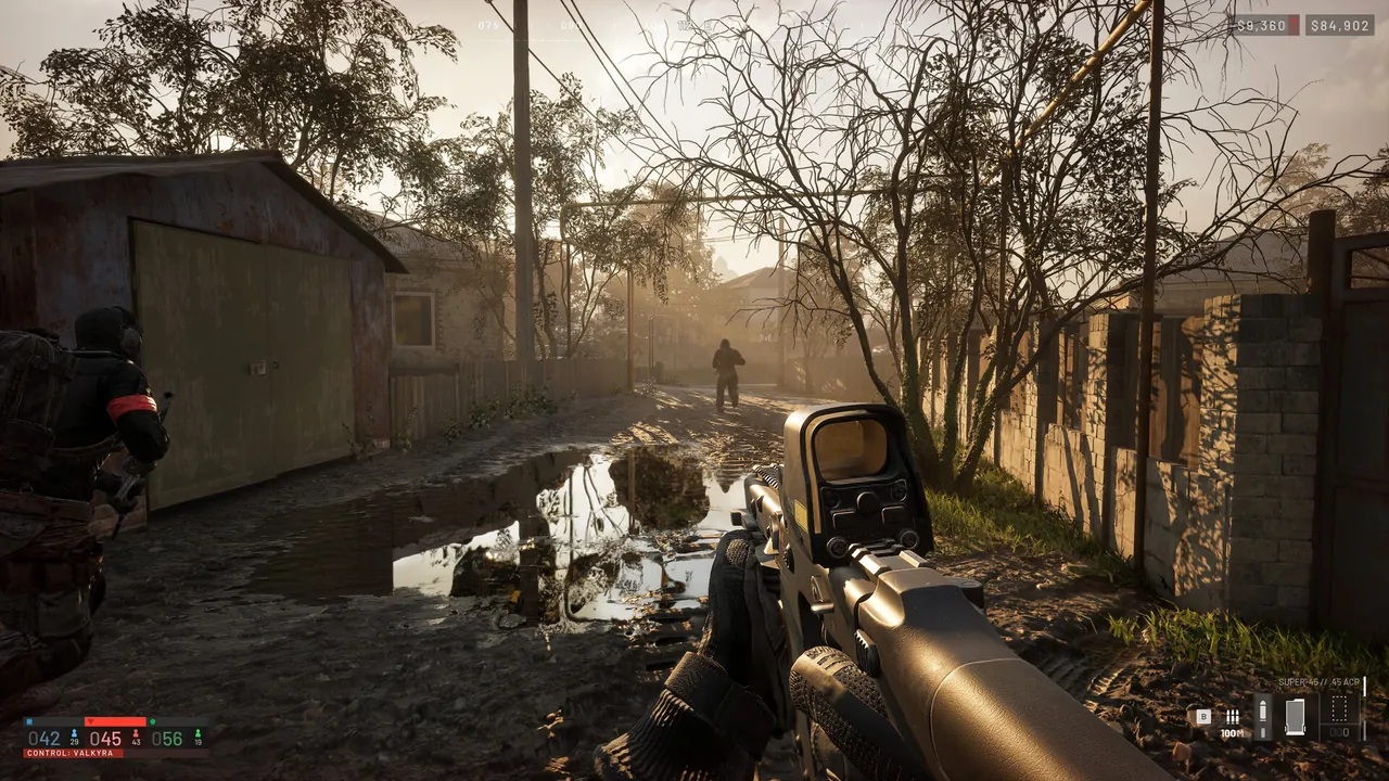
Flooded villages and settlements
Narrow streets with standing water, low walls, garden fences and single-storey houses to clear. Sightlines are short and broken; a marksman rifle is largely wasted money here while explosives and wall breaching are at their strongest. Interiors matter — official footage shows players clearing furnished rooms, so a zone over a village is a genuinely close-quarters fight despite the map's scale.
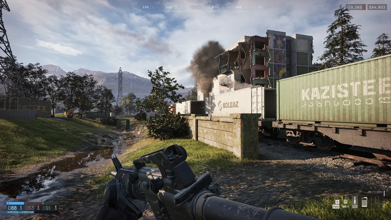
Industrial sites and container yards
Stacked shipping containers, rail infrastructure, warehouses and towers. This is the terrain that gives Kolchia its identity as a resource-war setting. Hard cover in abundance, awkward lanes for armour, and good ground for fortifications because structures break line of sight from artillery observation.
River crossings, valleys and open fields
The most punishing terrain for infantry on foot. Rivers and open valley floors create long exposed approaches, which is exactly where helicopter insertion and vehicles pay for themselves, and where a ghillie-suited marksman on a ridge can hold an entire approach alone.
Mountains and ridgelines
Kolchia is described as industrial mountains, and elevation shows up throughout official footage. Ridges determine which approaches into a zone are viable, provide cover from air observation, and are what makes a low-altitude helicopter approach survivable at all.
How to approach Bakurani
- Read the zone terrain before you buy The same map produces a village brawl or an open vehicle fight depending on where the square landed. Buying before looking is how money gets wasted.
- Solve transport early On 256 km², the team that gets bodies back to the zone fastest scores. A cheap light vehicle in the first minutes is worth more than a better rifle.
- Use terrain to hide a forward base Bakurani's ridges, treelines and industrial structures give plenty of ground where a FOB is close to the zone but not visible from it.
- Expect the third faction from a different direction Kolchia's valleys create natural approach corridors, and there are usually more than two of them into any zone.
- Fly low The mountain terrain is what makes helicopter approaches survivable against built anti-air. Straight lines at altitude are not.
Sniper spots and callouts
We are not publishing invented positions. Specific sniper nests, callouts, high-ground claims and rotation timings require the live build — they cannot be responsibly derived from trailer footage, and a map guide full of positions that do not exist is worse than no map guide.
What can be said now is the terrain logic: mountain ridges overlooking valley settlements, water towers and industrial structures giving elevation inside built-up areas, and long river crossings that reward anyone holding either bank. Tested positions, annotated overviews and Control Zone candidate locations publish here from 10 September 2026.
Other unknowns
- Whether the Control Zone can spawn anywhere on Bakurani or only at set candidate locations.
- Where each faction deploys, and whether deployment positions rotate.
- The names of the second and third Early Access maps, and whether they share Bakurani's terrain mix.
- Whether maps rotate automatically between matches.
Bakurani FAQ
What is the Bakurani map in WARDOGS?
Bakurani is a location in the Kolchia region and the first WARDOGS battleground shown publicly. It is 16×16 km with a randomised 2×2 km Control Zone.
How big is Bakurani?
256 km², the same as every WARDOGS map.
Where are the best sniper spots on Bakurani?
Verified positions require the live build. The terrain that will define them — mountain ridges over valley settlements, industrial towers, long river crossings — is visible in official footage, and tested positions publish after launch.
Is Bakurani the only map at launch?
No. Three Early Access maps are planned; Bakurani is the one shown publicly so far.
Can you play Bakurani in the beta?
Bakurani is the map that has been live in BULKHEAD's closed testing.
Sources: BULKHEAD and Team17 statements naming Bakurani as an Early Access battleground in Kolchia and confirming map dimensions; official WARDOGS screenshots from the Steam store page for terrain types. Terrain-based tactical reasoning is this wiki's own and is labelled as such. Back to all maps.